Overview
La Union is a coastal province located in the Ilocos Region on the island of Luzon in the Philippines. The province is officially designated as the Province of La Union and functions as an active administrative division within the country's northernmost island group. Its geographical position along the western coast of Luzon places it within the broader Ilocos Region, contributing to the region's coastal landscape and administrative structure. The province maintains its status as a key component of the regional framework, with its capital city playing a central role in local governance and regional coordination.
The capital of La Union is the City of San Fernando. San Fernando serves as the most populous city within the province and holds the additional distinction of being the regional center of the Ilocos Region. This dual role establishes San Fernando as a primary hub for administrative, economic, and social activities not only for La Union but for the surrounding provinces in the region. The city's position as the regional center underscores its importance in the Ilocos Region's organizational hierarchy and daily operations.
The provincial government of La Union operates under the local governing body known as the LGU name. This governing structure manages the province's affairs, implementing policies and services for its residents. The province is situated at coordinates 16.1117, 120.3720, which pinpoint its general location within the Luzon island geography. These coordinates reflect the province's placement along the western seaboard of Luzon, facing the South China Sea. The administrative center in San Fernando coordinates with the provincial government to ensure the delivery of services and the maintenance of infrastructure throughout the province.
As a coastal entity, La Union's identity is closely tied to its maritime boundaries and the broader Ilocos Region. The province contributes to the regional economy and cultural landscape, with San Fernando acting as the focal point for regional interactions. The active status of the province indicates its ongoing role in the Philippine administrative system, continuing to serve its population and maintain its position within the Ilocos Region on Luzon. The combination of coastal geography and regional centrality defines the province's current administrative and geographical profile.
Geography and Location
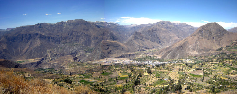
La Union is a coastal province situated in the Ilocos Region on the island of Luzon. The province is officially designated as the Province of La Union and maintains an active administrative status under the governance of its local government unit. Its geographic position places it firmly within the northern sector of Luzon, contributing to the broader demographic and economic landscape of the Ilocos Region. The province’s coastal orientation is a defining characteristic of its physical geography, influencing local climate patterns, settlement distribution, and economic activities along the shoreline.
Regional Context and Capital City
The City of San Fernando serves as the provincial capital of La Union. It is recognized as the most populous city within the province and functions as the regional center for the Ilocos Region. This dual role underscores San Fernando’s significance not only as the administrative heart of La Union but also as a central hub for the surrounding provinces in the region. The concentration of population and administrative functions in San Fernando reflects the urbanization trends typical of provincial capitals in Luzon, where infrastructure and services are centralized to support both local residents and regional visitors.
As the regional center, San Fernando hosts key government offices, educational institutions, and commercial establishments that serve the wider Ilocos Region. Its status as the most populous city in La Union indicates a higher density of residents compared to other municipalities and cities within the province, making it a focal point for economic activity and social interaction. The city’s role extends beyond local governance, acting as a gateway for travelers and researchers exploring the Ilocos Region.
Geographic Setting and Coastal Features
The province’s location on the island of Luzon places it in close proximity to other major geographic features of the northern Philippines. The coastal setting of La Union provides direct access to the West Philippine Sea, which has historically influenced trade, fishing, and transportation routes. The shoreline is characterized by a mix of sandy beaches, rocky outcrops, and coastal plains, supporting diverse ecological and recreational uses. These natural features contribute to the province’s appeal for tourism and local livelihoods, particularly in communities situated along the coast.
The Ilocos Region, of which La Union is a part, is known for its rugged terrain and varied landscapes, ranging from coastal areas to inland mountainous regions. La Union’s position within this region allows it to benefit from regional infrastructure networks and economic initiatives aimed at developing the northern part of Luzon. The province’s geographic boundaries are defined by its neighboring provinces, creating a contiguous landmass that supports agricultural production, residential development, and industrial growth.
The active status of La Union as a province indicates ongoing administrative and economic activity, with local government units managing public services, infrastructure, and community development projects. The province’s geographic and administrative characteristics are integral to its identity, shaping the experiences of residents and visitors alike. As part of the Ilocos Region, La Union contributes to the cultural and economic diversity of northern Luzon, maintaining its distinct identity while participating in broader regional dynamics.
Administrative Structure
La Union is a coastal province located in the Ilocos Region on the island of Luzon. The provincial government operates under the Local Government Unit (LGU) structure, with the City of San Fernando serving as the administrative capital. San Fernando is recognized as the most populous city within the province and functions as the regional center for the Ilocos Region. This central role positions San Fernando as the primary hub for regional administrative functions, economic activity, and public services for the broader Ilocos area.
Provincial Governance and Capital City
The governance of La Union is anchored in San Fernando, which holds the status of a component city within the province. As the capital, San Fernando hosts key provincial offices and serves as the focal point for inter-local government coordination. The city's designation as the regional center underscores its strategic importance in the Ilocos Region, facilitating administrative efficiency and resource distribution across the province. The LGU of La Union oversees the implementation of national policies and local ordinances, ensuring that the provincial administration aligns with the broader goals of regional development.
San Fernando's role extends beyond provincial boundaries, as it acts as a central node for regional governance. The city's infrastructure and administrative capacity support the needs of the Ilocos Region, making it a critical location for regional planning and execution. The provincial government works in tandem with the city administration to manage public services, infrastructure projects, and economic initiatives. This collaborative approach ensures that the capital city can effectively serve as the administrative heart of both the province and the region.
Administrative Hierarchy and Local Units
The administrative structure of La Union includes the City of San Fernando and several municipalities, each governed by its own local government unit. These local units operate under the oversight of the provincial government, contributing to the overall administrative framework of the province. The hierarchy ensures that governance is decentralized, allowing for localized decision-making while maintaining alignment with provincial and regional objectives. Each municipality and the city of San Fernando play a vital role in delivering public services and managing local resources.
The provincial government coordinates with these local units to implement development projects, manage public health initiatives, and oversee educational and infrastructural improvements. This multi-tiered administrative system enables La Union to address the diverse needs of its population while maintaining a cohesive regional strategy. The City of San Fernando, as the most populous center, often leads in pilot programs and regional initiatives, setting benchmarks for other local units within the province. This structure supports efficient governance and fosters collaboration across different levels of administration.
Regional Significance of San Fernando
As the regional center of the Ilocos Region, San Fernando holds a pivotal role in the administrative and economic landscape of Luzon. The city's status as the most populous city in La Union enhances its capacity to serve as a hub for regional activities. This includes hosting regional meetings, coordinating inter-provincial projects, and providing essential services to residents from surrounding areas. The provincial government leverages San Fernando's central location and administrative infrastructure to streamline regional governance and promote economic growth.
The administrative framework of La Union is designed to support the city's role as a regional center. This includes investing in infrastructure, public services, and economic development initiatives that benefit both the city and the wider province. The LGU of La Union ensures that the capital city remains equipped to handle its responsibilities as the administrative heart of the region. By focusing on San Fernando's development, the provincial government strengthens the overall administrative capacity of La Union and contributes to the progress of the Ilocos Region.
What is the population of La Union?
The demographic profile of La Union Province is anchored by its capital, the City of San Fernando, which serves as the most populous urban center in the region and functions as the regional hub for the Ilocos Region. As a coastal province situated on the island of Luzon, La Union’s population distribution reflects a concentration around this municipal core, which is governed by the local government unit (LGU) of San Fernando. The province maintains an active administrative status, with San Fernando acting as the primary node for regional services and demographic aggregation.
Available numeric data regarding the population presents a notable discrepancy in the source records. One dataset indicates a figure of 12827, which appears to represent a specific sub-unit or historical snapshot rather than the total provincial or city population, given the scale of San Fernando as the most populous city in La Union. This figure contrasts with the implied larger population of the city itself, which supports its role as the regional center. Without additional verified census data from the Philippine Statistics Authority or specific municipal records in the current grounding, the exact total population of the province or the city remains unspecified in the immediate data set. The figure of 12827 is retained as a recorded data point, though its scope—whether referring to a specific barangay, a historical count, or a sector-specific demographic—is not explicitly defined in the available snippets.
The governance structure, led by the LGU of San Fernando, oversees the demographic and administrative functions of the capital. As the most populous city in La Union, San Fernando’s population density and growth patterns are critical to understanding the province’s overall demographic health. The province’s location in the Ilocos Region on Luzon influences migration patterns and urbanization trends, with San Fernando acting as the primary destination for regional economic activity. The active status of the province indicates ongoing administrative and demographic monitoring, although specific annual growth rates or total headcounts beyond the noted 12827 figure are not provided in the current grounding materials. Researchers and planners relying on these figures should note the limitation of the single numeric data point and the need for corroborating sources to establish a complete demographic picture of La Union Province.
How does La Union compare to other Ilocos provinces?
La Union occupies a distinct position within the Ilocos Region, distinguished by its designation as the location of the regional center. The province’s capital, the City of San Fernando, serves as the administrative and commercial hub for the broader Ilocos area. This status differentiates La Union from its neighboring provinces, as San Fernando functions as the primary focal point for regional governance and development initiatives. The city is recognized as the most populous city within La Union, reinforcing its role as the central node for the region's activities.
The province is situated on the island of Luzon, maintaining its identity as a coastal province. Its geographic placement within the Ilocos Region allows it to act as a bridge between the northern and southern parts of the region. The administrative structure is managed by the local government unit, which oversees the province's active status. The coordinates 16.1117, 120.3720 pinpoint the central location of the province, highlighting its strategic position along the coast.
Regional Significance
As the home of the regional center, La Union plays a critical role in the administrative framework of the Ilocos Region. The City of San Fernando hosts various regional offices and institutions that serve the entire region. This concentration of administrative functions makes La Union a key player in regional planning and development. The province's status is further enhanced by its coastal geography, which influences its economic and cultural dynamics.
The comparison with other Ilocos provinces highlights La Union's unique characteristics. While other provinces may have significant historical or natural attractions, La Union's role as the regional center gives it a distinct administrative importance. The province's active status and well-defined local government structure ensure that it continues to serve as a vital component of the Ilocos Region. The city of San Fernando remains the most populous city in the province, underscoring its demographic and economic significance.
The province's location on Luzon and its coastal nature contribute to its identity. The administrative capital, San Fernando, is not only the provincial capital but also the regional center. This dual role amplifies La Union's influence within the Ilocos Region. The province's governance is carried out by the LGU, which manages the various municipalities and cities under its jurisdiction. The coordinates provided confirm the precise location of the province, aiding in geographical and administrative planning.
Significance
La Union holds a distinct administrative and geographic position within the northern Philippines as a coastal province situated in the Ilocos Region on the island of Luzon. Its strategic location along the western seaboard of Luzon places it at the intersection of the Ilocos corridor and the broader Luzon mainland, influencing its development as a key node in regional connectivity. The province is officially designated as the Province of La Union, a title that reflects its historical and political identity within the archipelago’s provincial system. The capital of La Union is the City of San Fernando, which serves not only as the provincial seat but also as the most populous city within the province. This demographic concentration in San Fernando underscores its role as the primary urban center for commerce, governance, and public services in La Union.
Regional Center of the Ilocos Region
The City of San Fernando functions as the regional center of the Ilocos Region, a designation that elevates its importance beyond the provincial boundaries of La Union. As the regional center, San Fernando hosts key administrative offices and serves as a focal point for regional planning and coordination among the four provinces of the Ilocos Region. This status is directly tied to San Fernando’s position as the most populous city in La Union, providing the critical mass of residents and economic activity necessary to sustain regional institutions. The concentration of population in San Fernando supports the infrastructure and services required for a regional center, including transportation hubs, educational facilities, and healthcare institutions that serve residents from across the Ilocos Region. The province’s role as the home of the regional center reinforces La Union’s significance in the broader administrative structure of northern Luzon.
Coastal Geographic Position
La Union’s identity is deeply shaped by its coastal geographic position on the island of Luzon. As a coastal province, it lies along the western coast of Luzon, facing the South China Sea. This coastal orientation has historically influenced the province’s settlement patterns, economic activities, and cultural development. The coastal location provides access to maritime routes and resources, distinguishing La Union from the more inland provinces of the Ilocos Region. The province’s status as an active administrative entity within the Philippines is maintained by its local government unit, which manages the coastal and inland territories under its jurisdiction. The geographic reality of La Union as a coastal province in the Ilocos Region on Luzon defines its physical and administrative context, linking it to the broader coastal dynamics of western Luzon while maintaining its distinct provincial identity.
Applications
The administrative structure of La Union Province, governed by its Local Government Unit (LGU) and centered in the City of San Fernando, provides a distinct framework for travelers and researchers navigating the Ilocos Region. As a coastal province on the island of Luzon, La Union’s geographic positioning offers specific logistical advantages and challenges that define the visitor experience. The capital, San Fernando, serves not only as the provincial seat but also as the regional center of the Ilocos Region, concentrating essential services, transportation hubs, and administrative offices in one accessible location. This centralization simplifies navigation for researchers seeking municipal records or travelers arranging inter-island transit, as most major roads and bus terminals converge in the city proper.
Geographic Accessibility and Coastal Logistics
La Union’s status as a coastal province directly influences its accessibility and tourism infrastructure. The coastline faces the South China Sea, creating natural conditions that have made the area a prominent destination for water sports and coastal exploration. For travelers, this geographic reality means that the primary points of interest are largely linear, following the coastal road that connects the various municipalities. Researchers studying coastal erosion, marine biodiversity, or climate change impacts can utilize the province’s active status and established LGU frameworks to access local data and site permits. The LGU’s role in managing coastal zones ensures that access to beaches and marine areas is regulated, providing a structured environment for both leisure and academic study.
The province’s location within the Ilocos Region also situates it along major north-south thoroughfares, linking it to Manila to the south and the Ilocos Norte province to the north. This connectivity allows for efficient day trips or extended stays, with San Fernando acting as a strategic midpoint. Travelers should note that the coastal geography can affect travel times during the rainy season, as the narrow strip of land between the sea and the Cordillera mountains is prone to specific weather patterns. Understanding these geographic constraints is essential for planning itineraries, particularly for those relying on public transportation or private vehicles along the coastal highway.
Administrative Framework for Researchers
For researchers, the active administrative status of La Union Province implies a functioning local government capable of issuing permits, managing archives, and coordinating with regional agencies. The City of San Fernando, as the most populous city and regional center, houses key offices that facilitate academic and journalistic inquiries. Researchers focusing on local history, urban development, or regional economics can leverage the concentration of institutions in San Fernando to access primary sources and interview local officials. The LGU’s governance structure ensures that data collection, whether for demographic studies or infrastructure assessments, follows standardized procedures, enhancing the reliability of findings.
Travelers and researchers alike benefit from the province’s clear administrative boundaries and active governance. The LGU’s management of public spaces, historical sites, and coastal resources ensures that visitors encounter a well-maintained environment. Whether exploring the cultural heritage of the Ilocano people or studying the ecological dynamics of the coastal zone, the structured approach of the La Union LGU provides a stable foundation for engagement. The province’s integration into the broader Ilocos Region further supports collaborative efforts, allowing for cross-jurisdictional research and travel opportunities that extend beyond the immediate provincial limits.