Overview
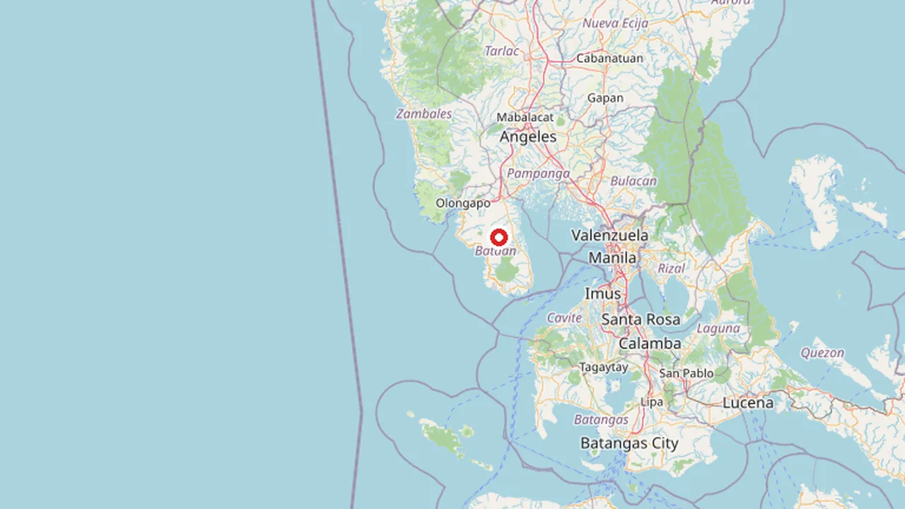
Bataan is a province located in the Central Luzon region of the Philippines, occupying the entirety of the Bataan Peninsula on the island of Luzon. The province is bordered by Zambales and Pampanga to the north, while its western coast faces the South China Sea and its north-western shore looks out over Subic Bay. To the east, the peninsula encloses Manila Bay, creating a strategic geographic position that has defined the province’s historical and economic trajectory. The capital of the province is the city of Balanga, which serves as the administrative center, while Mariveles is recognized as the largest town in the province. Established in 1757, Bataan is governed by the Provincial Government of Bataan, which oversees the development and management of this active and historically significant region.
Geographic and Strategic Position
The geography of Bataan is characterized by its peninsular shape, which projects into the South China Sea and creates a natural barrier along the western approaches to Manila Bay. This unique topography has made the province a focal point for both maritime trade and military defense throughout Philippine history. The coastline along the South China Sea offers extensive frontage, while the inland areas transition from coastal plains to hilly terrains that support diverse agricultural and industrial activities. The proximity to Subic Bay further enhances its connectivity to major ports and logistics hubs in the western part of Luzon.
Dual Identity: Heritage and Industry
Bataan is widely recognized for its dual identity as a repository of Philippine heritage and a growing industrial hub. The province is home to significant historical sites that commemorate key events in the nation’s struggle for independence and resilience during wartime. These historical landmarks attract researchers, students, and travelers interested in the rich narrative of Philippine history. At the same time, Bataan has evolved into a major center for industry and commerce. The presence of the Bataan International Airport and various industrial parks has spurred economic growth, drawing investment and creating employment opportunities for residents. This combination of historical depth and modern economic dynamism defines the contemporary character of the province.
History of Bataan: From Spanish Rule to WWII
Bataan, officially the Province of Bataan, is located in the Central Luzon region of the Philippines. Its capital is the city of Balanga, while Mariveles is the largest town in the province. The province occupies the entire Bataan Peninsula on Luzon. It is bordered by the provinces of Zambales and Pampanga to the north. The peninsula faces the South China Sea to the west and Subic Bay to the north-west, and encloses Manila Bay to the east. The Provincial Government of Bataan serves as the governing body. The province was established in 1757.
Early Inhabitants and Spanish Colonization
The early inhabitants of Bataan included the Aeta and Kapampangan peoples. Spanish colonization began in the 1570s. In 1647, a Dutch massacre occurred in the province. The province was officially established in 1757. The Spanish rule continued until 1818.
World War II: The Battle of Bataan and the Death March
Bataan played a pivotal role in World War II. The Battle of Bataan and the Death March were significant events that took place between 1941 and 1942. These events were crucial in the history of the province and the country.
| Year | Event |
|---|---|
| 1570s | Beginning of Spanish colonization |
| 1647 | Dutch massacre |
| 1757 | Establishment of the Province of Bataan |
| 1818 | End of Spanish rule |
| 1941-1942 | Battle of Bataan and the Death March |
Geography and Climate of Bataan
Bataan occupies the entire Bataan Peninsula, a prominent landmass extending southward into the South China Sea. The province is bordered by Zambales and Pampanga to the north, with Subic Bay situated to the northwest. To the east, the peninsula encloses Manila Bay, creating a strategic coastal geography that has influenced both trade and defense throughout Philippine history. The terrain is predominantly mountainous and rugged, characterized by two major mountain ranges that define the province's topography.
Topography and Mountain Ranges
The landscape of Bataan is dominated by the Natib Mountain Range and the Mariveles Mountain Range. These ranges run parallel to the peninsula's axis, creating a central spine of highlands that separate the western and eastern coastal plains. The Natib Range is located on the western side, facing the South China Sea, while the Mariveles Range lies on the eastern side, overlooking Manila Bay. This dual-range structure results in steep slopes and deep valleys, making inland transportation challenging and contributing to the province's dense forest cover. The highest peaks in these ranges provide natural watersheds that feed the province's river systems.
Rivers and Watersheds
Several rivers originate from the central mountain ranges and flow towards the coasts. The Talisay River and the Almacen River are among the most significant water bodies in the province. The Talisay River flows through the central part of Bataan, serving as a vital water source for agriculture and domestic use in municipalities along its banks. The Almacen River, located further south, drains into the South China Sea near the town of Alaminos. These rivers play a crucial role in the local ecosystem, supporting diverse flora and fauna, including several endemic species found in the Bataan Natural Park.
Coastline and Climate
Bataan features a long coastline along the South China Sea to the west and a shorter, more sheltered coast along Manila Bay to the east. The western coast is characterized by rocky shores and sandy beaches, while the eastern coast includes several natural harbors and estuaries. The province experiences a Type I climate, as classified by the Philippine Atmospheric, Geophysical and Astronomical Services Administration (PAGASA). This climate type is marked by two pronounced seasons: a dry season from November to April and a wet season from May to October. The dry season is further divided into the cool dry months of December to February and the hot dry months of March to May. The wet season brings heavy rainfall, primarily driven by the southwest monsoon and tropical cyclones, which can cause flooding in low-lying areas near the rivers and coasts.
Demographics and Culture
Population Statistics
The demographic profile of Bataan is characterized by a steady growth trajectory, driven by its strategic location between Metro Manila and the Central Luzon economic corridor. According to the 2024 census data, the province continues to be one of the most populous provinces in the Central Luzon region. The population density is highest in the capital city of Balanga and the southern municipality of Mariveles, which serves as the largest town in the province. This distribution reflects the administrative and military significance of these areas, with Mariveles hosting major naval facilities that attract civilian workers and their families.
Urbanization in Bataan is notable for its concentration along the coastal plains and the highway network connecting the peninsula to the rest of Luzon. The demographic structure includes a significant proportion of working-age adults, influenced by the presence of industrial zones and the military installations that have historically shaped the province's labor market. Migration patterns show a consistent influx of families from neighboring provinces such as Pampanga and Zambales, seeking employment opportunities in the growing service and manufacturing sectors.
Ethnic Groups and Languages
The cultural identity of Bataan is primarily Tagalog, reflecting its historical and linguistic ties to the broader Tagalog-speaking region. The Tagalog language serves as the lingua franca, used in daily communication, commerce, and local governance. However, the province also exhibits linguistic diversity due to its geographic position at the crossroads of several ethnic domains. The Kapampangan language is widely spoken, particularly in the northern municipalities bordering Pampanga Province. This linguistic overlap facilitates trade and social interaction with the neighboring Pampangan communities.
Indigenous heritage is preserved through the Ayta Magbeken people, an indigenous group native to the mountainous interior of the Bataan Peninsula. The Ayta Magbeken contribute to the province's cultural mosaic, maintaining traditional practices and a distinct linguistic heritage that coexists with the dominant Tagalog and Kapampangan influences. Their presence underscores the diverse ethnic composition of the province, blending lowland agricultural communities with highland indigenous groups.
Religious Composition
Religion plays a central role in the social fabric of Bataan, with Roman Catholicism being the dominant faith. The Catholic Church has a long-standing presence in the province, influencing local festivals, community organization, and educational institutions. The religious landscape is predominantly Catholic, with a significant percentage of the population identifying as members of the Roman Catholic Diocese of Balanga. This diocese oversees the spiritual and administrative needs of the faithful across the peninsula.
Alongside the Catholic majority, there is a growing presence of Protestant denominations, including the Iglesia ni Cristo, which has a strong organizational structure in the region. Other religious groups, such as the Baptist, Methodist, and Adventist churches, also maintain active congregations, contributing to the religious diversity of the province. The interplay of these religious communities fosters a vibrant spiritual life, marked by regular religious observances and community-based charitable activities that reinforce social cohesion in Bataan.
Industrial Zones and Manufacturing in Bataan
Bataan has evolved into a primary industrial hub for Central Luzon, driven by its strategic location on the Bataan Peninsula and extensive coastline. The province hosts several large-scale economic zones that attract multinational corporations, particularly in the petrochemical, power generation, and manufacturing sectors. These zones benefit from direct access to Manila Bay and Subic Bay, facilitating efficient logistics and export operations for local industries.
Freeport Area of Bataan (FAB)
The Freeport Area of Bataan (FAB) is the most prominent economic zone in the province. Established to boost foreign direct investment, the FAB offers tax incentives and streamlined customs procedures for businesses. It is home to major players in the power sector, including coal-fired power plants that contribute significantly to the Luzon Grid. The zone also hosts large-scale manufacturing facilities, including cement plants and steel mills, leveraging the peninsula's flat terrain and port accessibility.
PNOC Industrial Park and Petron Refinery
Adjacent to the FAB is the PNOC Industrial Park, which serves as a key energy hub. The park is anchored by the Petron Bataan Refinery, one of the largest oil refineries in the Philippines. This facility processes crude oil into various petroleum products, supplying fuel to Metro Manila and surrounding regions. The presence of the refinery has spurred the growth of supporting industries, including petrochemical plants and storage terminals, creating a clustered industrial ecosystem.
Other Ecozones and Industrial Clusters
Beyond the FAB and PNOC Industrial Park, Bataan features other designated ecozones such as the Bagac Ecozone and the Hermosa Industrial Park. These areas focus on diverse manufacturing sectors, including food processing, electronics assembly, and light engineering. The Bagac Ecozone, located in the northern part of the peninsula, benefits from proximity to the Zambales border and offers a mix of agricultural and industrial land use. The Hermosa Industrial Park caters to smaller and medium-sized enterprises, providing flexible leasing options and infrastructure support.
| Industrial Zone | Key Features |
|---|---|
| Freeport Area of Bataan (FAB) | Tax incentives, power generation, cement and steel manufacturing |
| PNOC Industrial Park | Petron Bataan Refinery, petrochemical clusters, energy hub |
| Bagac Ecozone | Food processing, electronics, agricultural-industrial mix |
| Hermosa Industrial Park | SME-focused, light engineering, flexible leasing |
Energy Infrastructure: Power Generation and Storage
The province of Bataan hosts a diversified energy infrastructure portfolio, serving as a critical power hub for the Luzon grid. This includes significant fossil fuel generation, a historic nuclear facility, and emerging renewable and storage assets. The energy mix reflects the province's strategic location and industrial demand.
Fossil Fuel Power Generation
Bataan is home to some of the largest coal-fired power plants in the Philippines. The Bataan Coal-Fired Power Plant, operated by Aboitiz Power Corporation, is a major contributor to the region's baseload power. It consists of multiple units with substantial installed capacity. Another key facility is the Bataan II Coal-Fired Power Plant, also operated by Aboitiz Power, which added significant capacity in the early 2010s. These plants utilize supercritical technology for efficiency. The province also hosts the Bataan Energy Corporation's facility, which includes oil and gas-fired units, providing flexibility to the grid. The environmental impact of these plants, particularly regarding air quality and water usage, is a subject of ongoing monitoring by the Department of Environment and Natural Resources.
Bataan Nuclear Power Plant
The Bataan Nuclear Power Plant (BNPP) is a prominent landmark in the province. Located in the municipality of Sta. Maria, it was constructed in the 1970s and early 1980s. The plant features a Westinghouse pressurized water reactor (PWR) with an installed capacity of 620 megawatts. Although it never officially commenced commercial operation, the BNPP remains a significant part of Bataan's energy history and potential. The facility has been the subject of various studies and proposals for reactivation, considering advancements in nuclear technology and energy security needs. The Provincial Government of Bataan has been involved in discussions regarding the plant's future, weighing economic benefits against public perception and safety standards.
Renewable Energy and Storage
In recent years, Bataan has seen growth in renewable energy projects. Solar photovoltaic farms have been developed, utilizing the province's sunny climate. These installations contribute to the diversification of the energy mix and help reduce reliance on fossil fuels. Additionally, battery energy storage systems (BESS) are being integrated into the grid to enhance stability and manage peak demand. These systems store excess energy generated during low-demand periods and release it during peak hours, improving overall grid efficiency. The Department of Energy supports these initiatives through incentives and strategic planning, aiming to increase the share of renewables in the provincial energy portfolio.
| Power Plant | Type | Operator | Installed Capacity | Status |
|---|---|---|---|---|
| Bataan Coal-Fired Power Plant | Coal | Aboitiz Power Corporation | 1,600 MW | Active |
| Bataan II Coal-Fired Power Plant | Coal | Aboitiz Power Corporation | 1,320 MW | Active |
| Bataan Nuclear Power Plant | Nuclear (PWR) | Philippine Nuclear Power Plant Corporation | 620 MW | Standby |
| Bataan Energy Corporation | Oil/Gas | Bataan Energy Corporation | 360 MW | Active |
Transportation and Connectivity
Bataan’s transportation network is defined by its peninsular geography, linking the mainland to the southern tip of the province through a combination of road infrastructure, maritime routes, and air connectivity. The primary arterial road is the Bataan Coastal Road, which runs along the western coast facing the South China Sea, connecting the northern municipalities to the capital city of Balanga and continuing south to Mariveles. This route serves as the main corridor for both commercial traffic and daily commuters, facilitating movement between the industrial zones and residential areas. The province is also connected to the rest of Central Luzon via the Bataan–Pampanga highway link, which interfaces with the MacArthur Highway system, providing access to Metro Manila and the northern provinces.
Maritime Connectivity and Seaports
Given its extensive coastline, Bataan relies heavily on its seaports for trade and passenger transport. The Port of Mariveles is the most significant maritime gateway, historically serving as a key entry point for goods and travelers heading to and from Metro Manila via Subic Bay. The port handles a substantial volume of cargo, including agricultural products and industrial materials, and supports regular ferry services that connect the peninsula to the northern Luzon ports. Other notable ports include the Port of Limay, which serves the central part of the province, and the Port of Orion, which facilitates local trade and fishing activities. These ports are crucial for the province’s economy, enabling the efficient movement of goods to and from the Bataan Economic Zone and other industrial areas.
Air Transport: Subic Bay International Airport
Although geographically situated in the neighboring province of Zambales, the Subic Bay International Airport (SBIA) serves as the primary air gateway for Bataan. Located in the Subic Bay Freeport, the airport offers both domestic and international flights, providing convenient access for residents and visitors to the peninsula. The proximity of SBIA to Bataan makes it a vital component of the region’s transportation infrastructure, supporting business travel, tourism, and cargo logistics. The airport’s modern facilities and strategic location enhance the connectivity of Bataan to major cities in the Philippines and international destinations, complementing the road and sea networks.
Proposed Infrastructure: Bataan-Cavite Interlink Bridge
To further enhance regional connectivity, the proposed Bataan-Cavite Interlink Bridge aims to link the province of Bataan with Cavite across Manila Bay. This ambitious infrastructure project is designed to reduce travel time between the peninsula and the southern Luzon region, particularly Metro Manila. The bridge is expected to alleviate traffic congestion on existing routes and stimulate economic growth by improving access to markets and industrial zones. While still in the planning and development stages, the Bataan-Cavite Interlink Bridge represents a significant step forward in integrating the peninsula’s transportation network with the broader regional infrastructure, promising to transform the logistical landscape of Central Luzon.
Tourism, Heritage, and Education
Bataan’s identity is inextricably linked to its pivotal role in Philippine and global military history, particularly during the Second World War. The province serves as an open-air museum, with the Mount Samat National Shrine standing as the most prominent heritage site. Located in the municipality of Balanga, the shrine features a 15-meter tall liberty statue that commemorates the sacrifice of the defenders of the Bataan Peninsula. The site offers panoramic views of the surrounding landscape and serves as a focal point for national remembrance. The historic Bataan Death March, one of the most brutal episodes of the war, left a lasting imprint on the province’s geography and collective memory. Numerous markers and monuments along the route from Mariveles to Capas in Tarlac honor the thousands of Filipino and American prisoners of war who endured the trek. These historical sites are maintained to preserve the narrative of resilience and endurance that defines the region’s past.
Ecotourism and Natural Attractions
Beyond its historical significance, the province offers diverse ecotourism opportunities. The Bataan Peninsula’s varied topography includes coastal areas, mountains, and river systems that attract nature enthusiasts. The Subic Bay area, located to the northwest, provides access to marine biodiversity and coastal landscapes. Visitors can explore the natural beauty of the peninsula, which contrasts with the historical weight of the war sites. The province’s geography, bordered by the South China Sea to the west and Manila Bay to the east, creates unique environmental conditions that support local flora and fauna. Ecotourism initiatives in Bataan aim to balance preservation with accessibility, allowing travelers to experience the natural heritage of the region alongside its historical landmarks.
Education and Local Institutions
The educational landscape of Bataan is anchored by the Bataan Peninsula State University (BPSU), a key institution in the province’s academic sector. BPSU plays a significant role in shaping the workforce and intellectual development of the region, offering various programs tailored to the local and national needs. The university’s presence in the province supports the educational aspirations of residents in Balanga and surrounding municipalities. Other educational institutions in Bataan contribute to the province’s human capital development, fostering a culture of learning and innovation. The integration of historical awareness into the local curriculum ensures that future generations remain connected to the province’s rich heritage, particularly the events of the Second World War that shaped the national identity.
See also
- Camarines Norte: Provincial Profile, History and Culture
- La Union: Province Profile, History and Cultural Heritage
- Masbate Province: Archipelagic Profile and Geographic Context
- Maguindanao del Sur: Province Profile and Administrative History
- Samar Province: Geographic Profile and Regional Context