Overview
Mount Banahaw stands as a prominent active complex volcano situated on the island of Luzon in the Philippines. This three-peaked volcanic structure is strategically located at the administrative boundary between the provinces of Laguna and Quezon. As a significant geological feature, it dominates the surrounding landscape for miles, serving as a central landmark for the region. The volcano is recognized as the highest mountain in both Laguna and Quezon provinces, as well as the entire Calabarzon region, marking it as a critical topographical high point in southern Luzon.
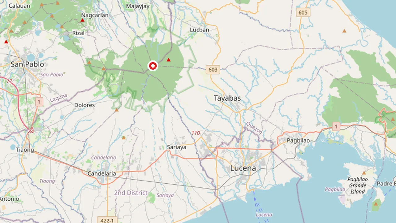
The entity is classified as an active volcano, indicating its ongoing geological potential and significance to regional monitoring efforts. It is governed and monitored by the Department of Environment and Natural Resources, which oversees its status and environmental impact. The volcano’s coordinates are fixed at 14.066666666667 latitude and 121.48333333333 longitude, placing it firmly within the shared municipal territories of Dolores in Laguna and Sariaya in Quezon. This dual-province location makes Mount Banahaw a shared natural heritage site, influencing the local geography, climate, and cultural identity of both administrative regions.
The complex nature of the volcano contributes to its distinct three-peaked silhouette, which is visible from various points across the Calabarzon area. Its status as the highest peak in the region underscores its importance in the local hydrological and ecological systems. The Department of Environment and Natural Resources continues to classify it as active, reflecting the need for sustained observation and management of its volcanic activity. This classification is crucial for the municipalities of Dolores and Sariaya, which share the mountain's slopes and valleys. The volcano’s prominence in the Luzon landscape is not merely topographical but also geological, representing a key feature in the volcanic arc of the Philippine archipelago.
Geology and Volcanic History
Mount Banahaw is classified as an active complex volcano situated on the island of Luzon in the Philippines. The volcanic structure is located at the administrative boundary between the provinces of Laguna and Quezon, serving as the highest mountain in both provinces and the broader Calabarzon region. Its three-peaked silhouette dominates the surrounding landscape, marking a significant geological feature in the southern Luzon volcanic arc.
Physical Characteristics
The volcano exhibits a complex topography characterized by andesitic composition. It rises to an elevation of 2170 meters above sea level. A defining feature of Mount Banahaw is its breached caldera, which measures 1.5 by 3.5 kilometers in diameter and reaches a depth of 210 meters. This structural formation results from past explosive activity and subsequent erosion, creating the distinctive multi-peaked profile observed today.
| Parameter | Value |
|---|---|
| Elevation | 2170 meters |
| Caldera Dimensions | 1.5 x 3.5 kilometers |
| Caldera Depth | 210 meters |
| Rock Composition | Andesitic |
| Volcanic Type | Complex Volcano |
Volcanic History
Historical records indicate significant eruptive activity that has impacted local settlements. Notably, an eruption in 1730 caused substantial destruction in the municipality of Sariaya. This event highlights the volcano's historical potency and its influence on the demographic and structural development of the adjacent Quezon province. The Department of Environment and Natural Resources monitors the volcano's status as active, reflecting ongoing geological processes within the caldera system.
Sacred Sites and Pilgrimage Tradition
Mount Banahaw holds a profound place in the cultural and spiritual landscape of the Philippines, widely recognized as a bundok dambana, or holy mountain. This designation reflects its long-standing role as a site of pilgrimage, devotion, and mystical encounter for communities across the Calabarzon region and beyond. The volcano’s three-peaked silhouette, which dominates the boundary between Laguna and Quezon provinces, has long been associated with divine presence and natural healing. For centuries, locals have attributed sacred qualities to the mountain, viewing it not merely as a geological feature but as a living repository of faith, folklore, and communal identity. The Department of Environment and Natural Resources oversees the area, balancing ecological preservation with the mountain’s enduring cultural significance.
The Legacy of Agripino Lontoc and the Santong Boses
The modern pilgrimage tradition at Mount Banahaw is deeply intertwined with the life and visions of Agripino Lontoc, a local mystic whose experiences in the mid-20th century helped crystallize the mountain’s spiritual reputation. According to local accounts, Lontoc heard the Santong Boses, or Holy Voice, emanating from the mountain, which guided him to specific sacred spots and revealed messages of healing and redemption. These revelations attracted followers who began to trek to the summit and surrounding slopes to witness the phenomena for themselves. Lontoc’s role as a spiritual intermediary transformed Mount Banahaw into a structured site of devotion, where pilgrims seek both physical and spiritual renewal. His legacy continues to shape the pilgrimage practices observed today, with many visitors retracing his steps and meditating at the locations he identified as spiritually potent.
Curative Springs and Natural Healing
In addition to its mystical associations, Mount Banahaw is renowned for the curative powers attributed to its natural springs. Local tradition holds that the mineral-rich waters emerging from the mountain’s slopes possess therapeutic properties capable of alleviating various ailments, from skin conditions to internal disorders. Pilgrims often collect water from these springs, believing that the combination of natural minerals and divine blessing enhances their healing potential. This belief in the mountain’s restorative powers complements the broader pilgrimage experience, drawing visitors who seek both physical relief and spiritual solace. The springs serve as tangible focal points for devotion, reinforcing the perception of Mount Banahaw as a holistic sanctuary where nature and faith intersect. These traditions remain vibrant, with countless individuals continuing to ascend the active volcano in search of the mountain’s enduring blessings.
Hiking Trails and Accessibility
Access to Mount Banahaw is facilitated by two primary hiking routes originating from the municipalities of Dolores in Laguna and Sariaya in Quezon. These paths provide distinct approaches to the active complex volcano, catering to varying levels of trekking endurance and scenic preferences. The Department of Environment and Natural Resources oversees the general governance of the site, ensuring that the landscape remains accessible while managing the volcanic terrain.
The Cristalino Trail
The Cristalino Trail is the more extensive of the two main routes, typically requiring approximately 9 hours to complete the round trip. This path is favored by trekkers seeking a longer immersion into the mountain's forested slopes and geological features. The trail winds through dense vegetation and offers a gradual ascent that allows hikers to acclimatize to the elevation gain before reaching the summit complex.
The Tatlong Tangke Trail
In contrast, the Tatlong Tangke Trail offers a more direct and shorter approach, with an estimated duration of 5 hours. This route is popular among those looking for a quicker ascent to the peak. The name "Tatlong Tangke," which translates to "Three Tanks," refers to the distinctive rock formations encountered along the path. This trail provides a steeper but efficient climb, making it a preferred choice for day hikers and those with limited time.
Summit Viewpoints
Upon reaching the summit, visitors encounter the Durungawan viewpoints, designated as I, II, and III. These vantage points offer panoramic views of the surrounding Calabarzon region, highlighting the volcano's dominance over the landscape for miles around. The three-peaked structure of Mount Banahaw is clearly visible from these spots, reinforcing its status as the highest mountain in both Laguna and Quezon provinces.
| Trail Name | Origin Municipality | Estimated Duration | Key Features |
|---|---|---|---|
| Cristalino Trail | Dolores, Laguna | 9 hours | Longer route, forested slopes, gradual ascent |
| Tatlong Tangke Trail | Sariaya, Quezon | 5 hours | Shorter route, "Three Tanks" rock formations, steeper climb |
Conservation Status and Management
Regulatory History and Access Restrictions
The management of Mount Banahaw has been characterized by significant regulatory intervention, primarily driven by the Department of Environment and Natural Resources (DENR). As the governing body responsible for the volcano’s ecological integrity, the DENR has implemented a series of hiking suspensions to mitigate environmental degradation. These measures reflect the tension between the mountain’s status as a major tourist destination and its fragile ecosystem.
The initial major suspension was enacted in 2004, marking a turning point in how the peak was managed. This decision was not a temporary measure but the beginning of a prolonged period of restricted access. The DENR cited the need for ecological recovery and better infrastructure as primary reasons for closing the trails to the general public. This 2004 closure set the precedent for future management strategies, establishing the department’s authority to regulate visitor flow to protect the three-peaked volcano’s landscape.
Extensions and Partial Reopening
Following the initial 2004 suspension, the DENR extended the restrictions in subsequent years to allow for continued environmental assessment and rehabilitation. Extensions were granted in 2012 and again in 2015, indicating that the ecological pressures on the mountain persisted despite the reduced visitor numbers. These extensions suggest that the initial measures were insufficient to fully address the pollution and wear on the trails, requiring a longer-term approach to conservation.
A significant shift in management occurred in 2019 with the partial reopening of Mount Banahaw. This decision marked the end of the long-standing suspension and allowed hikers to return to the trails. However, the reopening was not absolute; it was implemented with specific conditions aimed at controlling the volume of visitors and minimizing further environmental impact. The 2019 reopening represented a compromise between economic benefits from tourism and the ongoing need for conservation.
The primary driver for these regulatory actions has been pollution. The influx of tourists over the years led to significant littering and waste accumulation on the slopes of the volcano. The DENR’s interventions were directly targeted at addressing these pollution issues, aiming to restore the natural beauty of the mountain that dominates the landscape of Laguna and Quezon provinces. The management history of Mount Banahaw serves as a case study in balancing accessibility with ecological preservation in the Calabarzon region.
Biodiversity and Endemic Species
Ecological Significance of the Protected Landscape
Mount Banahaw serves as the ecological core of the Mounts Banahaw–San Cristobal Protected Landscape, a critical conservation area spanning the boundary between Laguna and Quezon provinces. This protected landscape preserves a significant portion of the Luzon montane rain forests, providing a vital habitat for a diverse array of flora and fauna. The mountain’s status as an active complex volcano contributes to unique soil compositions and microclimates that support specialized biological communities. As the highest peak in both provinces and the broader Calabarzon region, Mount Banahaw acts as a biological corridor, allowing species to migrate and maintain genetic diversity across the island of Luzon. The Department of Environment and Natural Resources oversees the management of this area, ensuring that the ecological integrity of the volcanic complex is maintained against anthropogenic pressures.
Endemic Amphibians and Reptiles
The amphibian fauna of Mount Banahaw is particularly notable for its high degree of endemism, especially within the genus Platymantis. These direct-developing frogs are among the most diverse vertebrate groups in the Philippine archipelago, with numerous species found exclusively on the mountain’s slopes. The moist, forested environments of the upper elevations provide ideal breeding grounds for these amphibians, which do not require a free-living tadpole stage, allowing them to thrive in varied terrestrial habitats. In addition to the rich frog populations, the mountain is home to the Banahao forest skink, a reptile species that has adapted to the dense undergrowth and leaf litter of the montane forests. These endemic species are indicators of the health of the forest ecosystem, as their survival is closely tied to the preservation of the native vegetation and the stability of the microclimates created by the volcanic terrain.
Mammalian Diversity
The mammalian community on Mount Banahaw includes four endemic rodent species, highlighting the mountain’s role as a refuge for small mammals in Luzon. These rodents have evolved in relative isolation, developing distinct characteristics that distinguish them from their counterparts in other parts of the island. The presence of these endemic rodents underscores the importance of the Mounts Banahaw–San Cristobal Protected Landscape in maintaining the biodiversity of the region. The complex topography of the volcano, with its three peaks and varied elevations, creates multiple ecological niches that support these specialized mammal populations. Conservation efforts within the protected landscape aim to safeguard these unique species from threats such as habitat fragmentation, invasive species, and climate change, ensuring that the ecological heritage of Mount Banahaw is preserved for future generations.
Why it matters
Mount Banahaw holds a distinct position in the geographical and cultural landscape of Luzon, primarily due to its status as the highest mountain in both Laguna and Quezon provinces. As the highest peak in the broader Calabarzon region, it dominates the surrounding terrain, serving as a prominent landmark visible for miles around. This geographical prominence is not merely topographical; it establishes Mount Banahaw as a central feature in the regional identity of the provinces it straddles.
Proximity to Metro Manila
One of the most significant aspects of Mount Banahaw is its relative closeness to the national capital. It is the closest mountain exceeding 2000 meters in elevation to Manila. This proximity makes it a unique geographical reference point for the Luzon island group. For researchers and travelers, this distance offers a rare combination of high-altitude terrain and accessibility from the country's most populous urban center. The volcano’s position allows it to influence local weather patterns and serve as a visual anchor for the eastern plains of Laguna and the western slopes of Quezon.
Spiritual and Cultural Landmark
Beyond its physical attributes, Mount Banahaw is recognized as a major spiritual landmark in Luzon. Its active volcanic status contributes to its mystique, drawing pilgrims, hikers, and spiritual seekers from across the archipelago. The mountain’s three-peaked structure is a defining characteristic noted in geological descriptions. Governed by the Department of Environment and Natural Resources, the site balances ecological preservation with its role as a cultural destination. The combination of its height, active status, and location at the boundary of two provinces underscores its importance in the regional heritage of the Philippines.
See also
- Mount Igmatindog: Geography and Conservation in Sibalom Natural Park
- Taal Volcano
- Mount Tabayoc: Geography and Significance in Benguet
- Macolod Corridor: Tectonic Setting and Volcanic Activity in Southwestern Luzon
- Mount Mayabobo: Geography and Tourism in Candelaria, Quezon